Screenshots
File Information
| Package Name | ua.com.deepstatemap |
|---|---|
| Version Name | 2.1.0 |
| Version Code | 221 |
| Architecture | Universal |
| Min Android Version | Android 24 (API 36) |
| Main Activity | ua.com.deepstatemap.MainActivity |
| Framework | Native (Java/Kotlin) |
| File Size | 28.76 MB |
| Signature (SHA1) | CC37EFDE5F198D0490322FA3C681A80156139F65 |
| File Hash (SHA256) | 36d62fc4fdba9292b7736bb2444a66e4c3b9e706aa4e3c3eea881879b3cad15f |
What's New
Deeplinking added
App Description
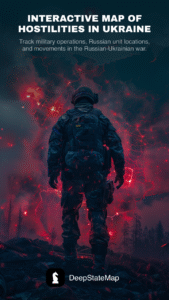
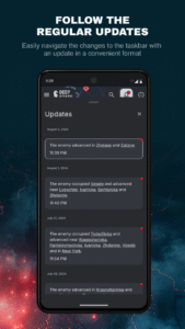
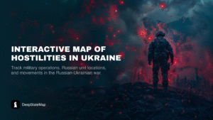
DeepStateMap.Live is an interactive online map of the hostilities in Ukraine that allows you to follow the course of military operations in the Russian-Ukrainian war, the location of Russian units and their movements.
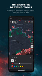
The application supports the possibility of caching downloaded data.
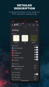
The map has symbols:
territory of Ukraine liberated from occupation in the last two weeks;
liberated territory;
territory that needs to be clarified;
territory occupied by Russian troops;
territory of the occupied Crimea and ORDLO;
territory of Transnistria;
rashists unit;
rashists headquarters;
rashists airfields;
rashists fleet;
directions of rashists attacks.
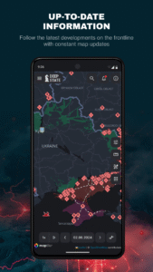
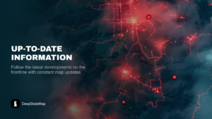
The territory is divided into zones, which are colored accordingly, and the locations of rashists units and airfields are marked. The site also has a news feed and the ability to measure distances between points on the map. The site allows to enable the display of fire points based on data from the NASA Firms system and compare them with the front line. A special mode makes it possible to measure the range of various artillery systems: HIMARS, M777, CAESAR, etc. along the entire front line.
The application supports the possibility of caching downloaded data.
The map has symbols:
territory of Ukraine liberated from occupation in the last two weeks;
liberated territory;
territory that needs to be clarified;
territory occupied by Russian troops;
territory of the occupied Crimea and ORDLO;
territory of Transnistria;
rashists unit;
rashists headquarters;
rashists airfields;
rashists fleet;
directions of rashists attacks.
The territory is divided into zones, which are colored accordingly, and the locations of rashists units and airfields are marked. The site also has a news feed and the ability to measure distances between points on the map. The site allows to enable the display of fire points based on data from the NASA Firms system and compare them with the front line. A special mode makes it possible to measure the range of various artillery systems: HIMARS, M777, CAESAR, etc. along the entire front line.
Download DeepStateMap APK
Fast, free and safe download.
APK Permissions 12
- android.permission.ACCESS_ADSERVICES_AD_ID
- android.permission.ACCESS_ADSERVICES_ATTRIBUTION
- android.permission.ACCESS_COARSE_LOCATION
- android.permission.ACCESS_FINE_LOCATION
- android.permission.ACCESS_NETWORK_STATE
- android.permission.INTERNET
- android.permission.POST_NOTIFICATIONS
- android.permission.VIBRATE
- android.permission.WAKE_LOCK
- com.google.android.c2dm.permission.RECEIVE
- com.google.android.finsky.permission.BIND_GET_INSTALL_REFERRER_SERVICE
- ua.com.deepstatemap.DYNAMIC_RECEIVER_NOT_EXPORTED_PERMISSION
APK Verified
The cryptographic signature guarantees that the file is safe to install and was not tampered with in any way.